Mount Ord
Fast Flight Facts
Target Species: Black-chinned Sparrow, Gray Vireo, Scott's Oriole, other chaparral/juniper species; Pine/Oak species in Transition Zones
Elevation: 4000' through 7100'
Habitat: Chaparral and juniper covered slopes in lower elevations, ponderosa pine and oak forest in transition zones
Overall Birding Rating: 5 (Top 10 Maricopa County Hotspot)
Difficulty: 3 (Moderate)
Birding Type: Moderate Hiking
Facilities: None; Convenient pull offs for camping overnight
Fees/Ownership: No fees, part of the Tonto National Forest
Closest Town or City/How far from Phoenix: Sunflower is the closest town, Mount Ord is 50 miles northeast of Phoenix
Getting there: Accessed from Highway 87 by a hard-packed dirt road that leads for seven miles to Mount Ord's summit
Overview: Located in the Mazatzal Mountains off of Highway 87, Mount Ord is the easiest transition zone forest habitat to access in Maricopa County. This amazing mountain area offers birders limited habitat and bird specialties of higher elevations within the county. Birding has good potential and possibilities here in all seasons, as the mountain road to the summit of Mount Ord starts off by going through upper sonoran habitat (chaparral, juniper) and continues up to transition zone forests (ponderosa pine, oak) that reach up to 7100' at the top. Maricopa County is limited on Mount Ord, as the majority of the area is in Gila County. However, a great amount of habitat is still in Maricopa County at every elevation this area has to offer.
Once turning on to Mount Ord from the highway, birding is good from the start as the upper sonoran habitat is a mix of chaparral and junipers with some agaves before one reaches the forested habitats further up. This stretch is one of the best spots (if not the best) to view Black-chinned Sparrows and Gray Vireos in Arizona. They can both be located easily in breeding season when the birds sing. The rolling-ball song of the Black-chinned Sparrow is incredible to hear when coming up here early in the morning, and they often can be heard singing throughout the day. Scott's Orioles reside in this area also, and should be kept in mind also when searching for Black-chinned Sparrows and Gray Vireos. Other typical birds to expect in the lower area of Mount Ord in season and year-round include Gambel's Quail, Cooper's and Zone-tailed Hawks, Golden Eagle, Common Poorwill, White-winged and Mourning Doves, Black-chinned, Anna's, and Costa's Hummingbirds; Say's Phoebe, Cassin's and Western Kingbirds, Western Scrub-Jay, Bridled Titmouse, Bushtit, Rock Wren, Northern Mockingbird, Phainopepla, Rufous-crowned Sparrow, Canyon and Spotted Towhees, Bullock's Oriole, and Lesser Goldfinch. Winter months have great potential in this habitat and will bring in abundant numbers of different sparrows in the upper sonoran, as well as more of the higher elevation birds irregularly such as Hairy Woodpecker and Pine Siskin.
As the ponderosa pine and oak that make up the transition zone is reached, it mixes well with the upper sonoran habitat and provides a great mix of species for both life zones, which are the Upper Sonoran and Transition Zone. Where these two zones meet, it's excellent place to still view Black-chinned Sparrows and sometimes Gray Vireos, as well as good breeding numbers of Blue-gray Gnatcatcher, Western Scrub-Jay, Virginia's Warbler and Spotted Towhee. Mount Ord provides excellent birding within the ponderosa pine and mixed oak forest, with many different species that favor the higher elevations. This begins at the first pine stands starting at Forest Road 1688 and continues to the summit of Mount Ord. Species that breed in this habitat at Mount Ord include Northern Pygmy-Owl, Broad-tailed Hummingbird, Acorn Woodpecker, Hairy Woodpecker, Northern "Red-shafted" Flicker, Western Wood-Pewee, Ash-throated Flycatcher, Plumbeous Vireo, Western Scrub-Jay, Violet-green Swallow, White-breasted Nuthatch, Bewick's Wren, Western Bluebird (sometimes), Hermit Thrush, Olive Warbler, Black-throated Gray Warbler, Grace's Warbler, Painted Redstart, Chipping Sparrow, Hepatic and Western Tanagers, Black-headed Grosbeak, and at times Red Crossbills. Owling at night has produced Spotted and Northern Saw-whet Owls. Other birds seen here sporadically throughout the year or in migration include Band-tailed Pigeon, Lewis's Woodpecker, Red-naped Sapsucker, Steller's Jay, Olive-sided Flycatcher, Hammond's, Gray, Dusky, and Cordilleran Flycatchers; Hutton's and Warbling Vireos, Red-breasted and Pygmy Nuthatches, House Wren, Ruby-crowned Kinglet, Townsend's Solitaire, Orange-crowned, Yellow-rumped, Townsend's, Hermit, and Wilson's Warblers; Green-tailed Towhee, Dark-eyed Junco, and Pine Siskin.
Birding Tip: To start off, the road up to Mount Ord is a dirt road that is in decent shape. It is in good condition for the most part, but it does have rough patches in places. Most passenger cars can handle this road. The road may also have seasonal problems with weather. In years with a lot of snow or rain, the road may be muddy or icy.
Birding wise, Mount Ord has good birding opportunities in all seasons, with the best times being April and May as migrants are passing through and breeding birds are starting to arrive. Summer can get very toasty up here, but the early morning hours are always very nice, so come early. Winter offers good possibilities, where anytime birding in the day would be a good option, especially in mid-morning. Winter birding may also bring in a northern surprise that may be very rare on a Maricopa County scale. Based on strictly Maricopa County, Mount Ord has it's limitations for the county lister. On the way up before the Transition Zone is reached, the county lines between Gila and Maricopa go back and fourth. However, there are good spots in the upper sonoran that are in Maricopa as well as three good spots in the transition zone forests. When in the upper sonoran habitat, there are many places in Maricopa to get out and search. One of them is at a corral within the first mile of driving. Park at this corral, and take a noticeable trail to the south through a fence opening. This path is excellent for viewing Black-chinned Sparrow, Gray Vireo, and more. Refer to a map to understand county lines better. After three miles of traveling on the road, the road will come in contact with the first stand of ponderosa pines. One will reach the road going to the right/south signed "1688". This entire two Road 1688 heading south is all in Maricopa County and provides excellent mixed habitat where the Upper Sonoran Zone meets the Transition Zone. On 1688, the regular forest birds are seen as well as the birds that favor the shrubby areas such as the Black-chinned Sparrows and at times Gray Vireos. Shortly after passing Road 1688 while driving on the main road, one is in Gila County entirely until the road dead ends near the mountain summit. Some of area near the top of Ord is in Maricopa as well. The dirt road ends at a gate near the summit, where only authorized personnel are permitted to proceed past the gate and up to the summit of Mount Ord. There is a parking area at this point, where hikers are welcome to hike up to the summit of Ord. This area is open from 9 A.M. to 6 P.M. and it is not permissible to drive past this gated point even if the gate is open. If hiking to the top where the tower is located, one will reach a sign that explains the tower is a half-mile away. Once past this sign, the entire half mile up to the top is in Maricopa County, where excellent oak habitat resides that has plenty of pine mixed in also. This upper level usually has similar diversity of pine and oak species as 1688 does, but it does attract breeders such as House Wren, Western Bluebird, and Chipping Sparrow. The forested slopes on the west side of the mountain from the tower that look downward on Road 1688 are all Maricopa County as well and are well worth the exploring and good potential. It is higher in elevation than road 1688 and might turn up a different species of note throughout the year. If parking at the parking area by the summit area, anything west of there is in Maricopa County. If one wants to walk down the forested slopes to explore, the pine forests on the upper western slope hold great potential too. By hitting a good combination of these spots and habitat differences, one is very likely to have a great outing when birding at Mount Ord! To get better overviews of this area, check out the Mount Ord Maps page under the "Pages" section on this page.
Directions: When coming north up Highway 87 (about 33 miles north of Highway 87 and Shea Blvd. intersection), Mount Ord is a well signed turnoff to the east side of the highway, with Sycamore Creek being the turnoff adjacent to the turnoff to Mount Ord. It is located just north of mile marker 222. The road to the summit area goes for six miles with many good spots and stops along the route. Check the Birding Tip and Maps Page for more information.
Pages:
Scenes and Sights from Mount Ord:
Scenes of the lower slopes of the Mount Ord area:
Scenes of Road 1688:
Scenes of the top of Mount Ord and upper slopes:
Winter:
Summer, Fall:
Birdlife of Mount Ord:
Black-chinned Sparrow
Gray Vireo
Northern Pygmy-Owl

Scott's Oriole

Painted Redstart

Hepatic Tanager
Western Tanager
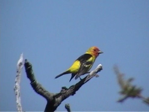
Grace's Warbler
Black-throated Gray Warbler
Virginia's Warbler
Northern Saw-whet Owl (one of two fledglings found together in May of 2014 by Kurt and Cindy Radamaker)-rare and local breeder in Maricopa County
Bridled Titmouse
White-breasted Nuthatch
Red-breasted Nuthatch
Western Bluebird
Violet-green Swallow
Olive Warbler
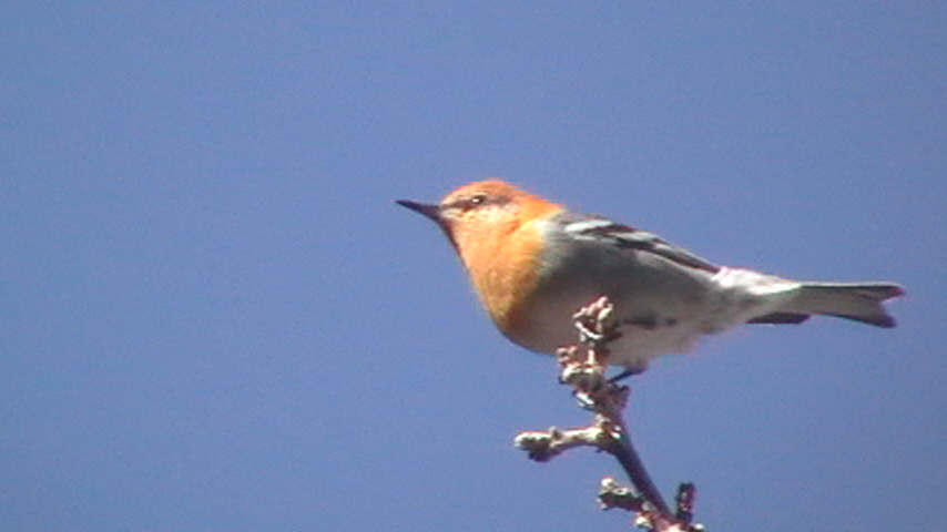
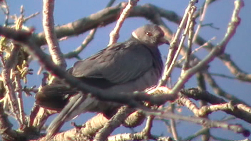
Band-tailed Pigeon
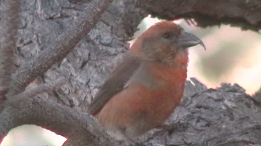
Red Crossbill (irregular fall and winter visitor, has bred)
Black-headed Grosbeak
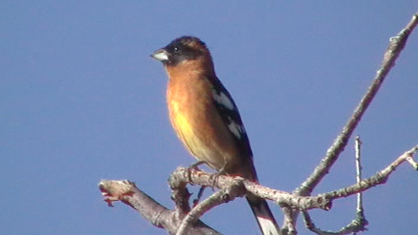
Cassin's Finch (Irregular winter visitor)

Plumbeous Vireo
Blue-gray Gnatcatcher
Mount Ord location maps
*all maps property of Google
Map # 1: Complete Overview of Mount Ord Area.
This map shows a complete overview of the Mount Ord area. After turning east off of the Beeline Highway (Highway 87) at the Mt. Ord turnoff just north of mile marker 222, this road travels up from 4000' to 7000' for 6.1 miles and ends near the summit of Mount Ord. This is a dirt road in good shape overall, with several rough patches. Most passenger cars can even handle this dirt road. There are many places to get out and bird en route to the ending point at 6.1 miles. At the ending point is a parking area, where one has the option to hike for 3/4 mile up to the summit of Mount Ord.
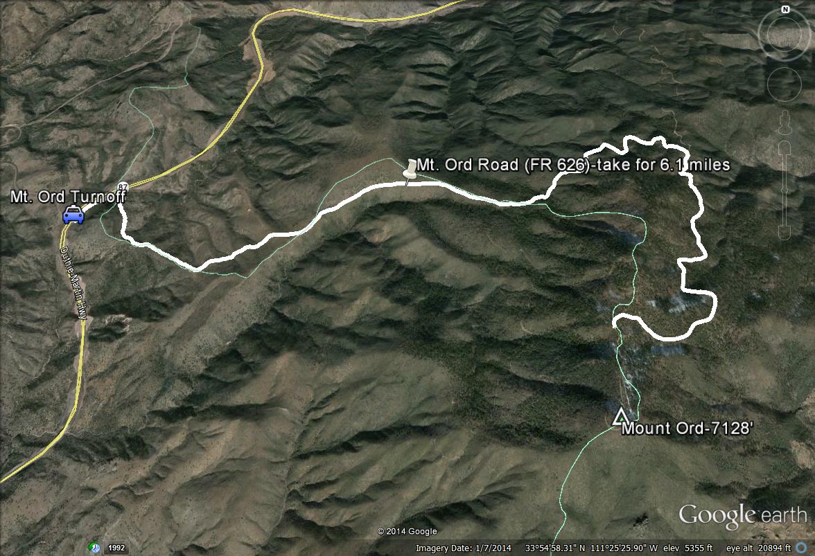
Map # 2. Birding Mount Ord's lower slopes and the first corral.
Mount Ord has habitat during the first three miles of the road that consist of the Upper Sonoran Life Zone with chaparral and juniper being the habitat makeup. This stretch crosses over the Maricopa and Gila County lines several times. After 1.1 miles of driving on the road east of the Highway 87 turnoff, one will come up on a corral on the south side of the road. Park here and walk through a fence opening on the east side of the corral. There is a hiking path that travels to the south. This trail is excellent for viewing Gray Vireo and Black-chinned Sparrow, and other chaparral and juniper species. The light blue line on the map above the start of the green path is the Gila/Maricopa County line, with Gila being north of the line.
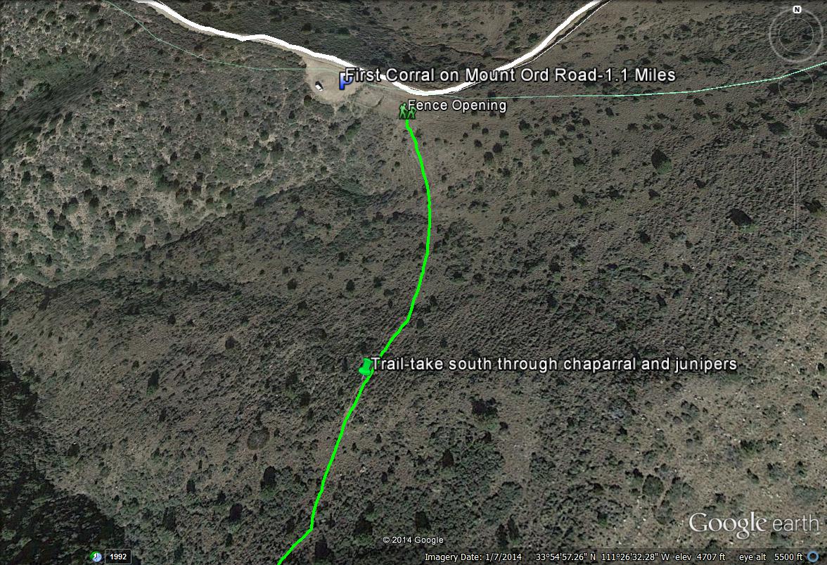
Map # 3: Accessing Road 1688.
Road 1688 is popular among birders due to it's close distance to the Highway 87 turnoff and quick access to tall ponderosa pine forest. It is also completely in Maricopa County for it's entire duration, being the one road in Maricopa County high country where county lines aren't ever an issue. Road 1688 is three miles from the start of Mount Ord Road after turning off of Highway 87, and it is on the south side of the road. It is easily found as the road comes into contact with stands of pine trees. There are noticeable places to park by the start of 1688. Forest Road 1688 travels for 1.8 miles south through ponderosa pine/oak forest as well as chaparral and juniper habitats. It is a great place to see a variety of birds. Features of the beginning stretch of this road include an old cattle loading chute and a small water trough.
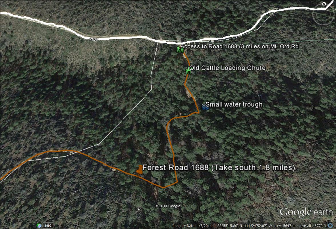
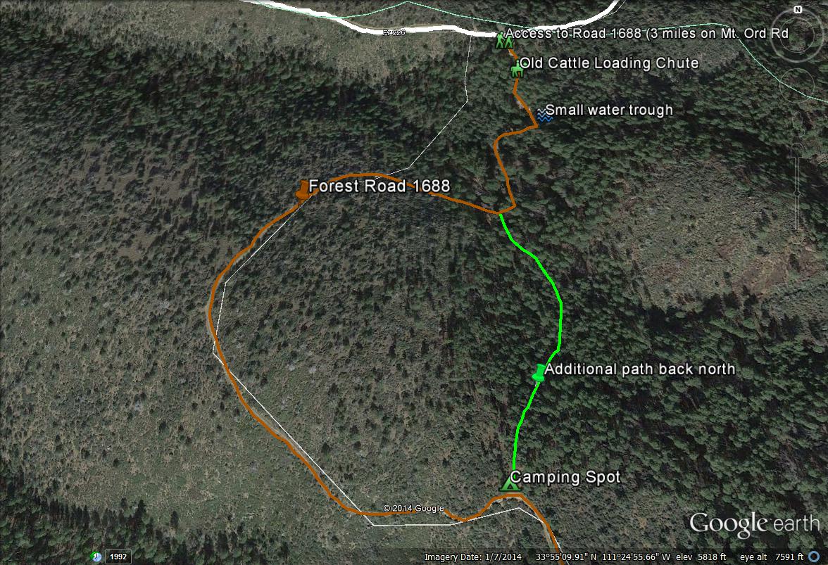
Map # 4: A quick loop hike near the beginning stretch of Road 1688.
If one is wanting to do a quicker hike on Road 1688 without hiking it to the end, there is a possible loop hike one might want to do. After passing through the first stand of pines, one will venture back out to the western direction and will come out into chaparral and juniper habitat. The road will curve back to the east again and there will be a stand of ponderosa pine on the north side of 1688, which is part of the first big stand. There is an old camping area here. Walk north and down through the pines, which follows a path. This path will take one back to the water trough and back down to 1688, completing a nice little "loop" through a good habitat variety.
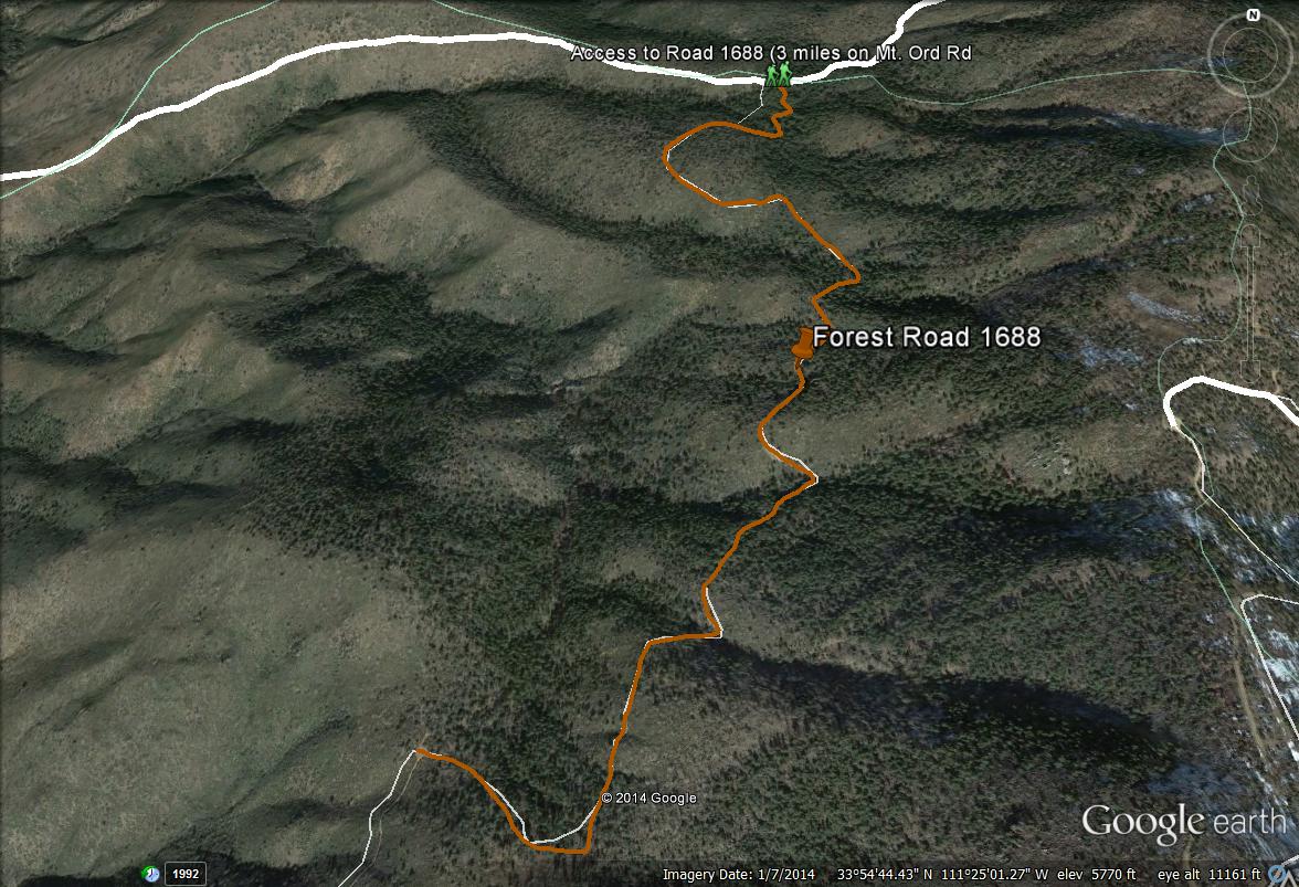
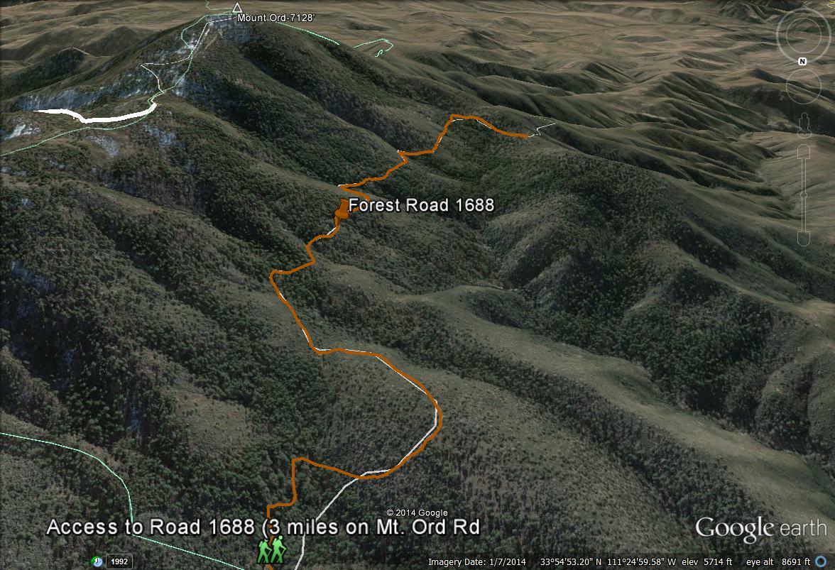
Maps 5 and 6: Overviews of Road 1688.
Two maps are included for overviews of Forest Road 1688. As mentioned above, Road 1688 travels for 1.8 miles south through great habitat, and it is all completely in Maricopa County. The top map will show views facing north and the bottom map shows views facing south. The bottom map with the views of 1688 facing south also shows good views of Mount Ord's western slopes as well as the summit. These western slopes are all completely in Maricopa County also. The elevation of Forest Road 1688 is roughly 6000' throughout most of it's duration.
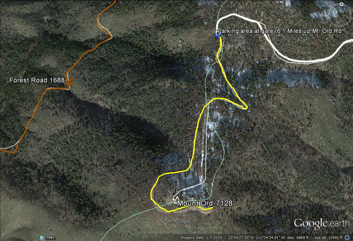
Map # 7: Accessing the Summit of Mount Ord.
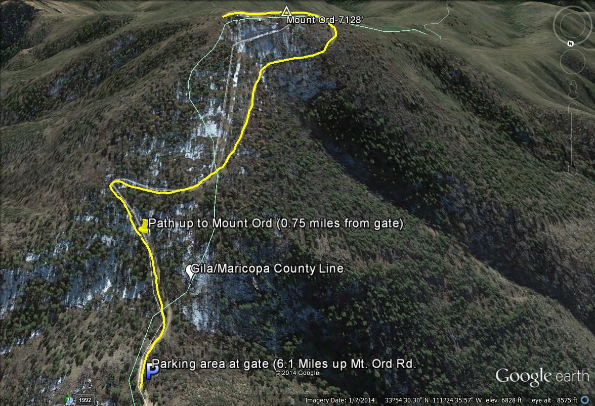
After 6.1 miles of driving on Mount Ord Road towards Mount Ord from Highway 87, the road comes to a dead end. There is a gated area which prevents further vehicular access. One is allowed to hike past this point towards the summit of Mount Ord for 3/4's of a mile (indicated on this map by a yellow line path). This area is open from 9 A.M. through 6 P.M. While hiking up in this area, Maricopa County is reached after passing the sign that indicates, "Mound Ord Lookout-1/2 mile away). In the upper slopes of Ord near the parking area, some of the road area is in Maricopa County too, including the parking lot. Refer to maps for exact locations.
Map # 8: Another view of the summit area from Mount Ord while facing south.
This map shows the summit area of Ord if facing south. Points that are illustrated are the path to the summit, the Gila/Maricopa County line, the parking area, and the summit of Mount Ord. Maricopa County is on the right side of the line, which is west.
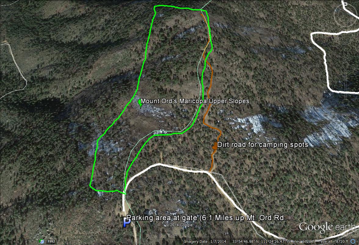
Map # 9: Birding Mount Ord's upper western slopes in Maricopa County.
If parking at the end of the road near the gate or by following a dirt road (hiking is more recommended, it's a rough road) shortly northeast of the gate through camping areas (accessed from the north side of Mt. Ord Road), one can bird Mount Ord's higher and western facing slopes. These slopes are rather steep, but one can easily bird them without going down too far. There is a good stretch of habitat to bird along, and the stands of pine and oak here are excellent for finding Transition Zone species. On the map, refer to the area between the light green border, which is easily accessed from Mount Ord Road (ivory-white path) and the dirt road leading through camping spots (brown path). Forest Road 1688 can be seen on the western border of this map, which is 800 feet lower than these upper slopes.
No comments:
Post a Comment