Sunflower (Old Beeline Highway)
Fast Flight Facts
Target Species: Sycamore canyon riparian birds, juniper and chaparral birds
Elevation: 3500-3700'
Habitat: Sycamore riparian canyon with juniper and chaparral covered surrounding hillsides
Overall Birding Rating: 5 (Top 10 Maricopa County Hotspot)
Difficulty: 1 (Easy)
Birding Type: Easy Hiking, Owling
Facilities: None
Fees/Ownership: No fees
Closest Town or City/How far from Phoenix: Sunflower (closest town); 45 miles northeast of Phoenix
Getting there: Accessed from mile marker 222 (signed off as Sycamore Creek) on the west side of Highway 87
Overview: Sycamore Creek runs through this beautiful place called Sunflower, which is accessed off of Highway 87 to the historic Old Beeline Highway (which is closed to motor traffic). By walking on this road, it takes the birder through medium elevations of 3000 to about 4000' feet. Sycamore Creek is lined with Arizona sycamores, willows, cottonwoods, and mesquite in the mix. Juniper trees are dominating in the surrounding hills. Sunflower is a superb birding area in all seasons, as it has full breeding birdlife as well as an abundance of migrants and wintering birds.
Perhaps Sunflower is the most famous for the easy and up close viewing of Common Black-Hawks as well as Zone-tailed Hawks. These two species are both highly vocal, especially the Zone-tailed, who has a high pitched scream that is a common call echoing the surrounding hills. The Black-Hawks prefer the access road when coming in off of the Highway 87, and are often seen roadside. The Zone-tailed Hawks are more often back on the Old Highway, where they are usually seen along the creek. Sunflower also provides excellent breeding habitat for species such as Cooper's Hawk, Brown-crested Flycatcher, Yellow-billed Cuckoo, Western and Cassin's Kingbirds, Bell's Vireo, Juniper and Bridled Titmice, Rock and Canyon Wrens, Lucy's and Yellow Warblers, Yellow-breasted Chat, Summer Tanager, Rufous-crowned Sparrow, Canyon Towhee, Blue Grosbeak, and Bullock's and Hooded Orioles. Gray Vireos can sometimes be seen and heard on the juniper hillsides, as well as Black-chinned Sparrow in habitats with a hint of chaparral. Night birding in spring can produce Elf Owl, Western Screech Owl, and Common Poorwill. Spring and fall migrations provide tremendous numbers of migrants and this place should always be checked. Winter is excellent at Sunflower for large numbers of American Robin, Cedar Waxwing, Western Bluebird, Hermit Thrush, and Dark-eyed Junco. Red-naped Sapsuckers, Townsend's Solitaire, and Green-tailed Towhees are other wintering birds to expect.
Birding Tip: Sunflower is proficient in all seasons. Visit during spring and fall migrations as many different passerines are on the move. In summer, come early to avoid the heat. Before going back on the Old Highway, bird the sycamores and habitat along the entrance road, which is along where Common Black-Hawks are often seen. Many birds can be observed along this area as well. Once back on the Old Highway, there is an alternative to bird from the road or to walk over and bird along the creek bed. CAUTION-some points are extremely steep to navigate through when walking down to the creek where there is rough vegetation. If wanting to walk over to access the creek: watch your footing, try to find a safe way down, and keep an eye out for rattlesnakes. Birding down in the creek bed would probably give birders a better chance at seeing more species, although birding from the highway is highly effective. Once hiking over a mile back on the old highway, the Sunflower Workstation is reached. This area has mesquite bosque alongside the normal creek side habitat, and it is easy to walk down in the habitat and bird. It usually turns up a wide variety of species, and the creek bed is easily accessed from here. The surrounding juniper hillsides should also be birded thoroughly. In April through June, make a night birding trip, listen for Elf and Western Screech-Owls as well as Common Poorwills. Winter birding here can be excellent with bird abundance, as well as slow and quiet. It is higher in elevation here than Phoenix, prepare to dress warmly in the winter months.
Directions: The Sunflower area's main access point is on the west side of Highway 87 (Beeline Highway) at Mile Marker 218. There is a noticeable turn here on the west side of the Beeline. Take this road for over a mile until it dead ends at a barricade at the end of this road. Past the barricade is the Old Beeline Highway. Park at the circular dead end and walk past the barricade and follow the paved Old Beeline Highway further north for close to two miles. Birding is excellent along this stretch year round. The entrance road after turning off of Highway 87 is a great place to bird also. Going further north on Highway 87, another place to access Sycamore Creek is found just north of Mile Marker 222, which is also on the west side of Highway 87. There is a sign pointing to go to Mount Ord on the east, and Sycamore Creek on the west. Follow this road for a few miles to access the creek at it's upper reaches.
Pages:
Scenes and Sights from Sunflower:
Sunflower in early spring:
Sunflower in the summer months:
Sunflower in the winter months:
Birdlife of Sunflower:
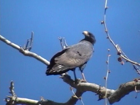
Common Black-Hawk
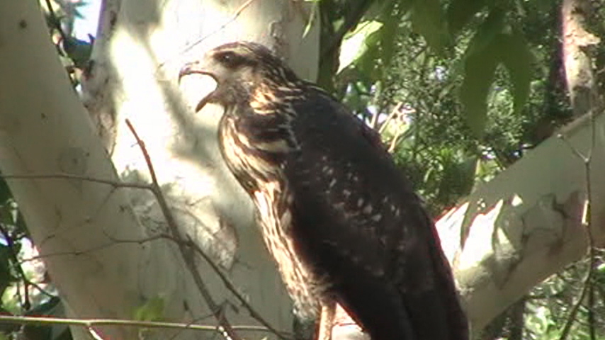
Juvenile Common Black-Hawk
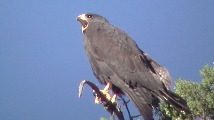
Zone-tailed Hawk
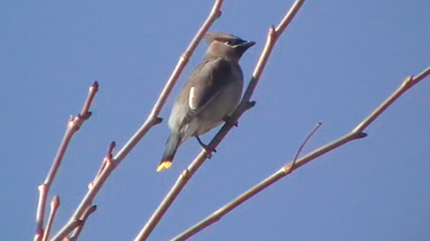
Cedar Waxwing
Fox Sparrow

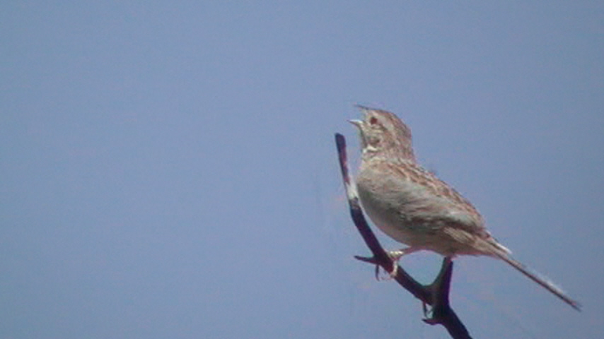
Cassin's Sparrow (rare in Maricopa County)
Richard Crossley (rare migrant)
Maps of Sunflower
*all maps owned by Google
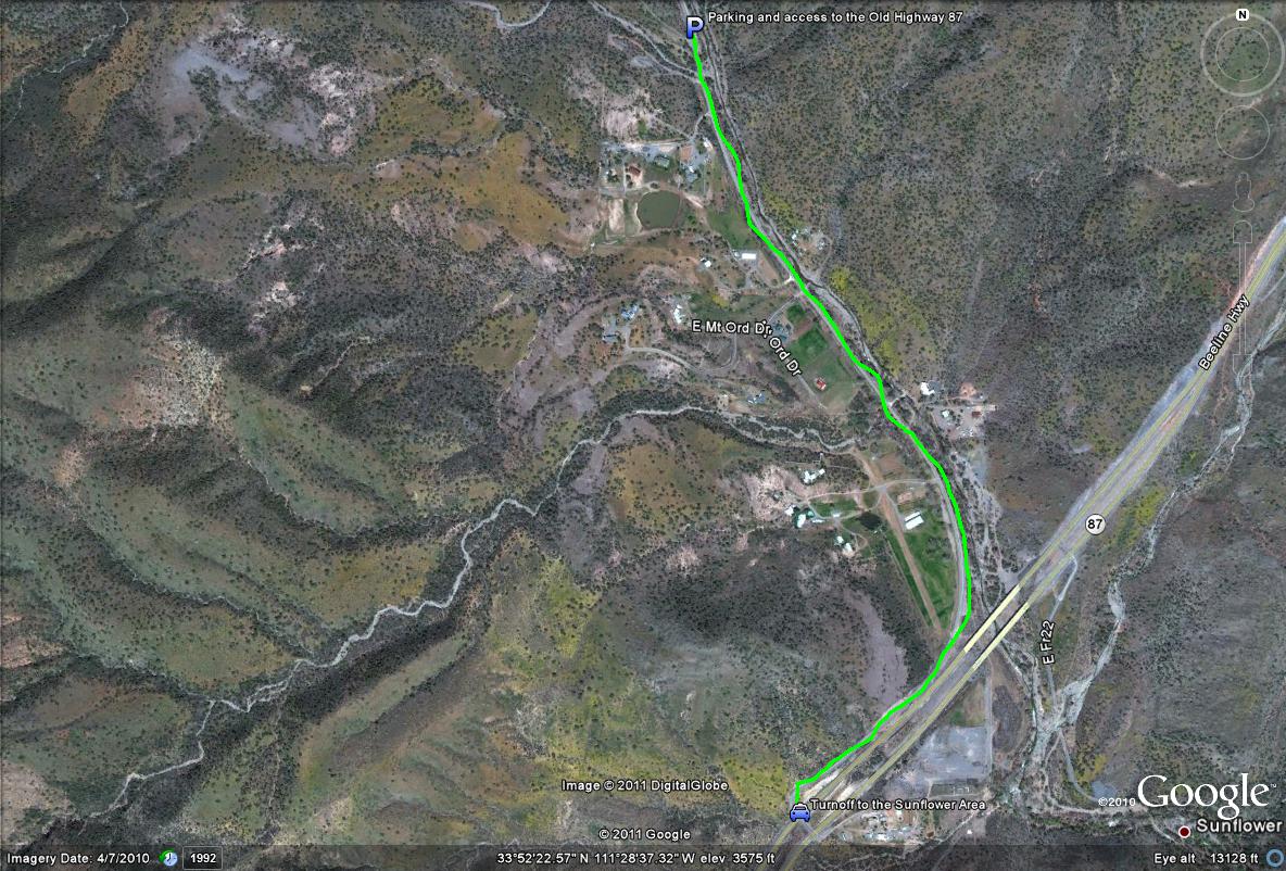
Map # 1-Access to the Sunflower Area
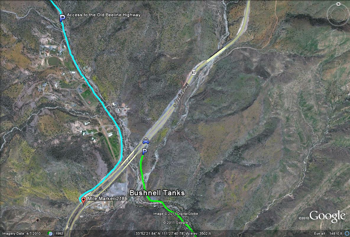
Car symbol-This symbol shows were you can exit off the Beeline Highway to access the Sunflower Area whether you are coming north and south along the highway. The turnoff to Sunflower is just north of mile marker 218. If you reach the turnoff to Bushnell Tanks while heading north, than you have come too far.
Lime-green line path-This line shows the entrance road to drive on to the dead end parking area, which is 1.5 miles in length. Once the dead end is reached, continue past the dirt beams and road closed signs north to explore the Old Highway 87. By walking along this entrance road, the birding is very productive as well.
P-shows were parking is to access the Old Highway 87.
The Sunflower area's main access point is on the west side of Highway 87 (Beeline Highway) at Mile Marker 218. There is a noticeable turn here on the west side of the Beeline. Take this road for over a mile until it dead ends at a barricade at the end of this road. Past the barricade is the Old Beeline Highway. Park at the circular dead end and walk past the barricade and follow the paved Old Beeline Highway further north for close to two miles. Birding is excellent along this stretch year round. The entrance road after turning off of Highway 87 is a great place to bird also. Going further north on Highway 87, another place to access Sycamore Creek is found just north of Mile Marker 222, which is also on the west side of Highway 87. There is a sign pointing to go to Mount Ord on the east, and Sycamore Creek on the west. Follow this road for a few miles to access the creek at it's upper reaches.
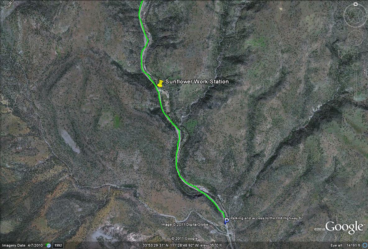
Map # 2: Birding stretch along the Old Highway 87 (Beeline): After parking at the end of the road through Sunflower, walk north past the barricade at the dead end of the road up the Old Beeline Highway. Walking over a mile up to the Sunflower Work Station and back will usually result in a productive outing.
Map # 3: An overview of accessing the Old Beeline Highway and the Bushnell Tanks in the Sunflower Area:
The turnoff to the Bushnell Tanks is on the east side of the Beeline Highway and is only 0.5 miles north of the turnoff to Sunflower.
No comments:
Post a Comment